Customizable maps, 3D rendering, offline operation, dynamicity and more
Mapbox is a U.S. service that provides customized online maps for websites, makes them adaptable to the graphics of one's site, target users, and provides various services to make the map even more unique and suitable for any need, gives developers the opportunity to create their own map that can meet the requirements to the letter, without limitations.
The service is used by many famous brands such as Snapchat and Tinder, and also by couriers such as DHL and DPD group.
Unlike Google Maps, Mapbox has an SDK available to anyone, so it provides all the necessary elements for web mapping and applications for web functionality.
The services that Mapbox provides are several, and all of them ensure complete customization of the maps, their function, and interface.

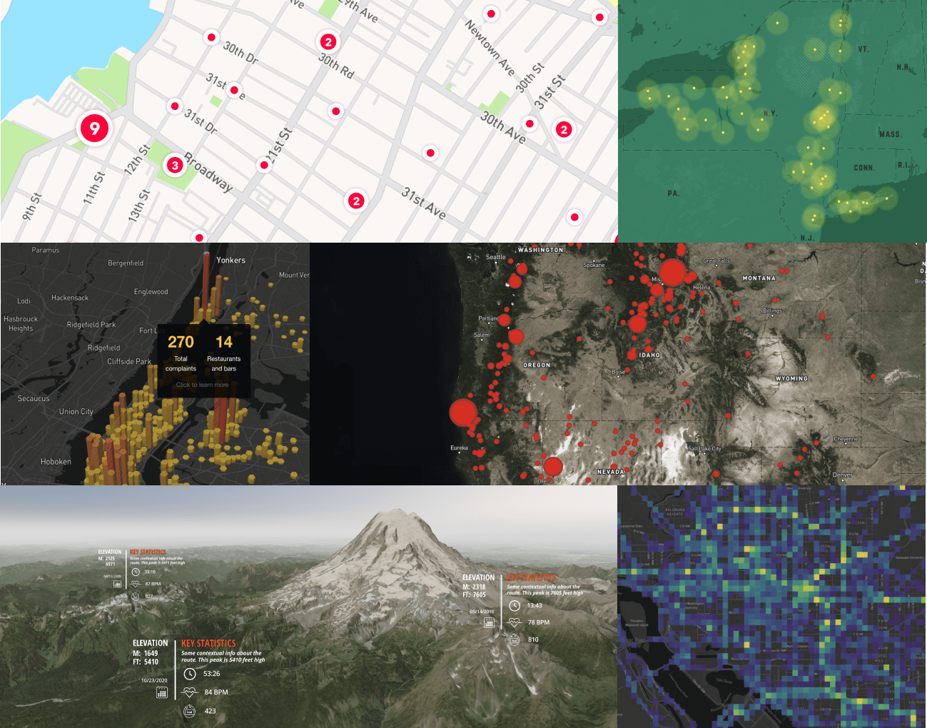
Maps, the first service, makes maps available for you to use in your project, allows you to have broad views on data control, can create, manage and export maps with custom data, and dynamically add maps between different platforms. The Studio service, on the other hand, makes the map fully customizable, allowing you to change fonts, icons and textures, offers the ability to import your own data to create a custom coropletic map, and creates a realistic map using 3D with Mapbox GL JS.

The latter is a JavaScript library for vector maps on the Web, is designed to best render even the most detailed and dense maps on both desktop and mobile devices, and improves loading times while ensuring excellent performance.
The map can be made fully interactive, and various GL JS functions can be used to display data at scale, such as through heatmaps. One can also add three-dimensional elements and details making the map even more realistic such as depth, sky, sun and fog.
To make a very detailed map, one needs great address coverage, Search is the perfect service: it offers complete address coverage throughout North America, Europe, and other geographic areas, is updated regularly, and has 70% accuracy on signal location, it also increases the ease of searching for hard-to-find addresses.

Mapbox GL JS vector maps are also supported by the Atlas service, which allows them to be quickly rendered offline and be highly customizable. In addition to this it allows you to develop custom mapping and location applications from start to finish in your own private cloud or on-premise infrastructure. It gives the ability to run APIs on a private server that you have full management of.
Enabling 3D terrain is incredibly easy with Mobile Map SDK, and so is its use; intelligent support of predefined gestures provides intuitive interaction in two or three dimensions. Camera capabilities allow you to show users every inch of the map you want to highlight, and it will be simple, performant, and familiar to design with the integration of animation systems.

The Data service provides mapping and location data that can be added to any map, Mapbox Boundaries, which is a comprehensive geospatial analysis, Mapbox Traffic data, makes all traffic data available for accurate time estimates and efficient dispatch, Mapbox Movement, provides data on population movement, while Movement Data provides up-to-date information of where people move most, and global coverage, for all of which the data is kept anonymous.

Boundaries is the service that enables geospatial analysis and visualization to derive valuable information from any dataset. Typically, datasets simplify boundaries, making visualizations inaccurate, Mapbox Boundaries polygons, on the other hand, always perfectly match adjacent boundaries, so that the entire world can be visualized more clearly. Geospatial data, on the other hand, are transformed into vector tiles by the Mapbox Tiling Service, which continuously updates maps as the data changes and provides a region-wide, high-speed, low-latency redundant caching network for scalability in any geographic area.

To provide a safe driving service, Navigation SDK is the best choice. It is a navigator with maps conceived and designed exclusively for navigation, which shows real-time traffic and possible accidents and suggests an alternative route, warns about speed limits and alerts if the limit is exceeded, and is able to work even when there is no GPS signal. Dash, on the other hand, always offers a safe navigation service, but based on reading millions of sensors, streaming traffic and maps updates in real time, location accuracy is very high, keeps up to date on speed limits, fuel and parking, also has a voice assistant and a fully customizable design that can adapt to any style and model of car.

The Vision service enhances the previous two, adding visualization of signs, traffic lights, certain road features and critical events, if the car's sensors are connected it can also understand the scene in real time by detecting possible hazards. You can add context to navigation by creating a feature-rich experience with augmented reality, add more details, parking suggestions or maneuvering indicators.


Mapbox's Static Maps are optimized for performance and simplicity. Static Maps is the service that handles their management. Static maps can be displayed anywhere an image can be inserted, even in applications or user interfaces where interactive maps cannot be displayed. No need to use special libraries or SDKs, with this option you can quickly create detailed, feature-filled maps with just a few lines of code.
Thanks to the Address Autofill service all you have to do is start filling in the destination field and all possible solutions will be proposed in a cascade. Once you find the one you are looking for you will have to confirm its correctness, and if you want, you can also save it. The option is very convenient especially for small mobile devices, and again the interface is customizable.

Should you find yourself on a site where you cannot insert maps, Static Maps is the ideal solution. Mapbox's Static Maps are optimized for performance and simplicity. They can be used to display maps wherever an image can be inserted, even in applications or user interfaces where interactive maps cannot be displayed. There is no need to use special libraries or SDKs, with this option you can quickly create detailed, feature-filled maps with just a few lines of code.
Published by: ChristinaChan
Date: 26-05-2022