


Papasidero is reported for the first time in Norman-Swabian documents around 1200, it is described as an inhabited center surrounded by walls and defended by a castle. The castle, with a single semicircular tower, stands on a rocky outcrop overlooking the Lao river; it constitutes the connecting point of a large wall, for long stretches still visible, in which doors opened. Of probable Lombard origin, the castle was a bulwark against the Saracen raids very frequent between 994 and 1044 BC.
The original nucleus of the country was formed, therefore, under the Lombards, around the year 1000, after the decline of the Roman Empire, in the climate of repopulation of the countryside, favored by the colonization of Greek monasticism, whose asceters for some time now dotted the whole the Mercurion area, and by the lordships immigrated from the Lombard territories of Salerno.

The phenomenon of emigration to Latin American countries, but especially to France, Germany, Switzerland and the regions of Northern Italy, has decimated the population of the country which now slightly exceeds the thousand inhabitants.
Except for the parenthesis of belonging to the Sanseverino (1354) and to Accursio Pappacoda of Naples (1414), from the XVI and up to 1722 the village belonged always to the Alitto family, which fell in the wake of Roberto il Guiscardo during the Norman period.
Returned to benefit the Royal Court, the fief of Papasidero was purchased by the Spinelli di Scalea who kept it from 16 November 1724, to the subversion of feudalism in 1806.
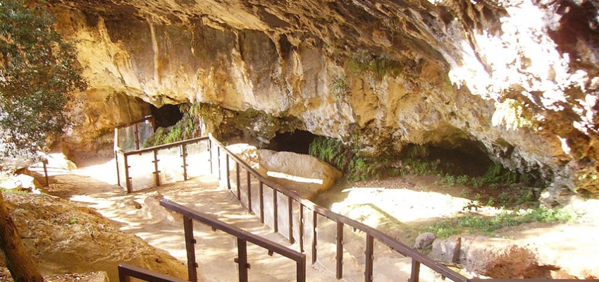
Romito cave
Address: Via Grotta del Romito 87020 Frazione, Bivio Avena O Vuccale CS
Phone: 0981 83078
Site:
Location inserted by
Bonometti Paola