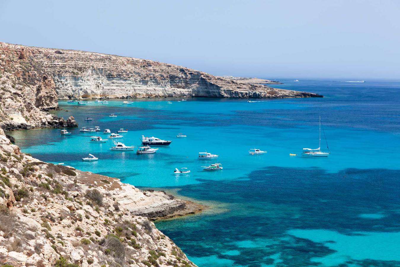


The island has an elongated shape and measures from W to E, 10.8 km, while at the widest point, from N to S, it measures 3.6 km, for a perimeter development of 33.3 km. Geologically it is a Horst and belongs to Africa; like Pantelleria it is closer to the Tunisian coasts, distant from these 113 km (and 150 km from Malta), than to the Sicilian ones, from which 205 km separate it; the maximum depth of the arm of the sea between Lampedusa and Africa is 120 m. The highest point of the island is Albero Sole, at 133 m altitude. Lampedusa is also the southernmost inhabited center of Italy: it is in fact located at the latitude of 35 ° 30 'N, further south of Tunis and Algiers. Starting from the marina and, going west, you will find the inlet where the Guitgia beach is located, beyond this, which closes the inlet of the port to the west, the next stretch of coast is characterized by peaks and coves of morphological interest such as Cala Croce and Cala Madonna, particularly deep, Cala Greca and Cala Galera. After a stretch of higher coast, which surmounts the bay of Tabaccara, you reach the island of Rabbits which is a few tens of meters from the coast where the beach of the same name is located, and where Domenico Modugno once spent his holidays and where he died on August 6, 1994.

Immediately afterwards there is Cala Pulcino and Vallone dell'Acqua. On the northern side of the island characterized by high and jagged coasts in Punta Parise we find a particularly large cave with a narrow entrance, which allows access only by swimming, and inside which there is a small sandy beach. Continuing west, here begins a stretch of coast characterized by the presence of the Pignolta, Sacramento and Faraglione rocks, followed by Punta Muro, Punta Cappellone which drops down over the sea, Cala Ruperta, Punta Taccio Vecchio and Punta Alaimo which mark a long particularly wild coast. Another point of interest is the lighthouse of Capo Grecale, from which along a large bay called the Dead Sea, and very popular with boats and divers attracted by the variety of fish fauna, you reach Punta Parrino, which closes the gulf, and Punta Sottile where some coves of the southern slope open, such as Cala Francese, at the bottom of which there is a beach near the airport.
Island of Lampedusa
Address: Via Vittorio Emanuele, 33, 92010
Phone:
Site:
http://www.comune.lampedusaelinosa.ag.it/Location inserted by
Culturalword Abco