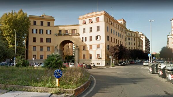
Casal Bertone Neighborhood
Casal Bertone, the neighborhood emerged in the late 1920s in an area of the former Roman countryside characterized by a vast hill, part of the Portonaccio hills, where the ancient Casale or Vaccheria Bertone stood.
This place may have taken its name from the ancient owners or perhaps from the "bertone" coat, a term for the horses bred there. Nearby, there was still a road dating back to at least the early Middle Ages, the vicolo di Malabarba, named for the presence of an oratory with an attached mill, the Mola di Santa Barbara.
This road represented what remained of the suburban section of the via Collatina, a Roman road that connected Rome to Collatia, a town located near the present-day "La Rustica" district.
Additionally, in the area, a Military road was planned, outlined in the 1883 Regulatory Plan, called via di Portonaccio.
This road was supposed to be part of a defensive system for the city designed by the Minister of War Luigi Mezzacapo.
The Military road connected via Tiburtina to via Casilina, passing through the valley of Marranella, known in this area as Fosso dell'Acqua Bullicante.
The area was already delimited by the railway tracks of the Rome-Ancona, Rome-Tivoli, and Rome-Orte lines, as well as the Prenestina Railway Station to the south and Tiburtina to the north, built in the last twenty years of the 19th century as part of the modernization of Rome, the new capital of the Kingdom of Italy.
In the same period, significant industrial plants had developed, such as the Society for the Electrification of Railways (near the Prenestina Station) and the chemical industry of CISA-Viscosa (near today's Largo Preneste).
The first buildings in the area were constructed following the approval, in 1926, of a variant to the 1909 Regulatory Plan by Edmondo Sanjust di Teulada.
This variant foresaw the construction of public housing and was implemented by private individuals or state-owned companies such as the Railways or the Tramways Company.
The streets of the new neighborhood, initially referred to as the Tiburtino suburb, were named after figures from the Risorgimento and the unification of Italy.
In March 1944, during World War II, Casal Bertone was hit by massive Allied bombings that affected many popular neighborhoods in Rome.
Although there were no civilian casualties, the neighborhood suffered significant damage to its buildings.
One of these, partially collapsed, remained visible on Via Antonio Baldissera until 2006 when restoration and reconstruction work began, completed in 2010.
In 1945, the construction of the parish church, dedicated to Santa Maria Consolatrice, was completed. In 2010, the municipal administration selected the neighborhood as a pilot area to experiment with a sustainable neighborhood model, as part of the Cat-Med project (Change Mediterranean Metropolis Around Time), promoted by the European Community and involving a total of 12 Mediterranean cities.
In March 2014, Casal Bertone hosted the second edition of the "Nuova Gestione" project, an urban redevelopment initiative for the city of Rome promoted by the association Sguardo Contemporaneo.
After a first experience in the Quadraro district, the project again involved citizens and artists with the aim of revitalizing an area increasingly subject to abandonment, temporarily reactivating disused or unused commercial spaces through site-specific works created by a group of artists.
Map: Casal Bertone Neighborhood
Address: Piazza Santa Maria consolatrice, Quartiere Casal Bertone Roma Italia
Roma (RM) Lazio
Latitude: 41.898012742080645
Longitude: 12.53565788269043
Site: https://www.romacentrale.it/ca...
vCard created by: BBCC
Currently owned by: BBCC
Type: Zone
Function: Square
Creation date: 10-01-2024 06:27
Last update: 10/01/2024