The archaeological area of Tindari
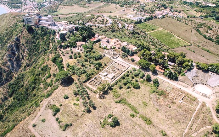
The archaeological area of Tindari was an ancient Greco-Roman city founded by Dionysius of Syracuse in 397-6 BC. as a fortress and military outpost.

Occupied by the Carthaginians, led by Hannibal, in 264 BC, conquered by the Romans ten years later, it owes the end of its era to a landslide first, then to an earthquake around 365 AD, and finally to the devastation of the Arabs in 836 AD.

In the area it will be possible to visit:
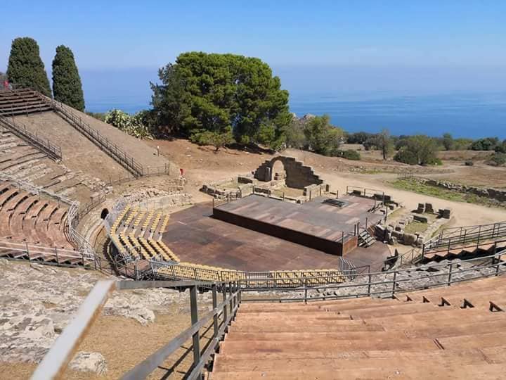
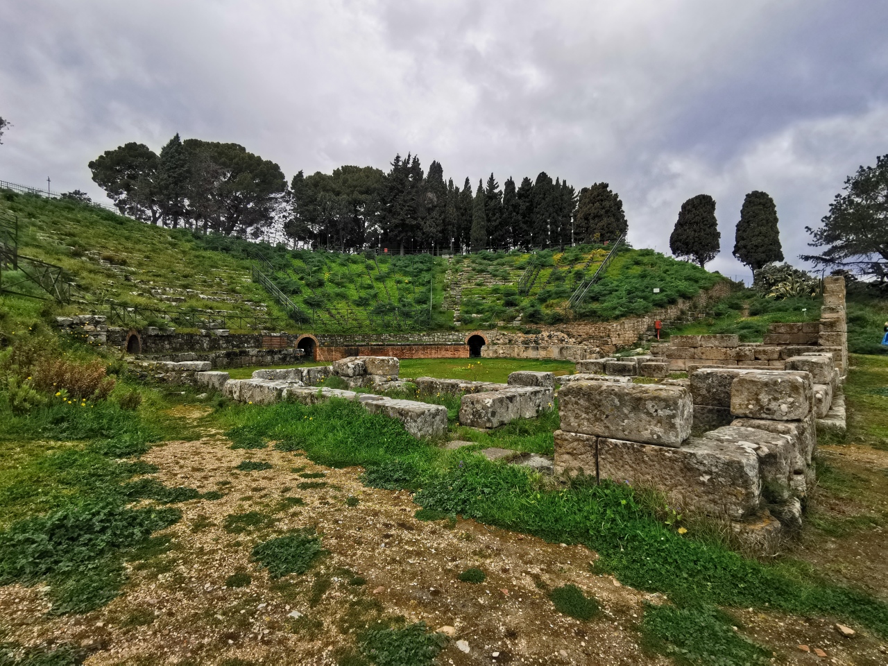
The Greco-Roman theater built with blocks of sandstone by the Greeks in the 3rd century BC, modified by the Romans to adapt it to circus games, part of the urban layout of the city which was crossed by three large parallel arteries (decumani) in the east- west, intersected perpendicularly by narrower roads (cardines) in a south-north direction;
The remains of two houses of the peristyle type with tablinium;

The thermal baths consist of a courtyard, a frigidarium with a bathtub, two tepidariums, a calidarium;

The monumental propylaum built by the Romans with 2 large sandstones and destined to the Basilica for public meetings, or to the Gymnasium for athletic exercises;
The remains of the Cyclopean walls, built by Dionigi; a tower (16th - 17th century), located near the theater;

The Antiquarium, located at the entrance to the excavations, in which marble statues of toga characters, a head of the emperor Augustus, a Corinthian capital, bronze age ceramics, Roman republican-imperial oil lamps, work tools are exhibited and many other historical artifacts found on site.

Video: The archaeological area of Tindari
Map: The archaeological area of Tindari
Address: Via Monsignor Pullano, 54, 98066, Messina
Patti (ME) Sicilia
Latitude: 38.143429543639655
Longitude: 15.044000744819641
Site: https://www.beniculturali.it/l...
vCard created by: CHO.earth
Currently owned by: CHO.earth
Type: Area
Function: Archaeological site
Creation date: 11-10-2021 07:18
Last update: 11/10/2021