Pietragalla - Urban Park of the Palmenti - Virtual Tour 360°
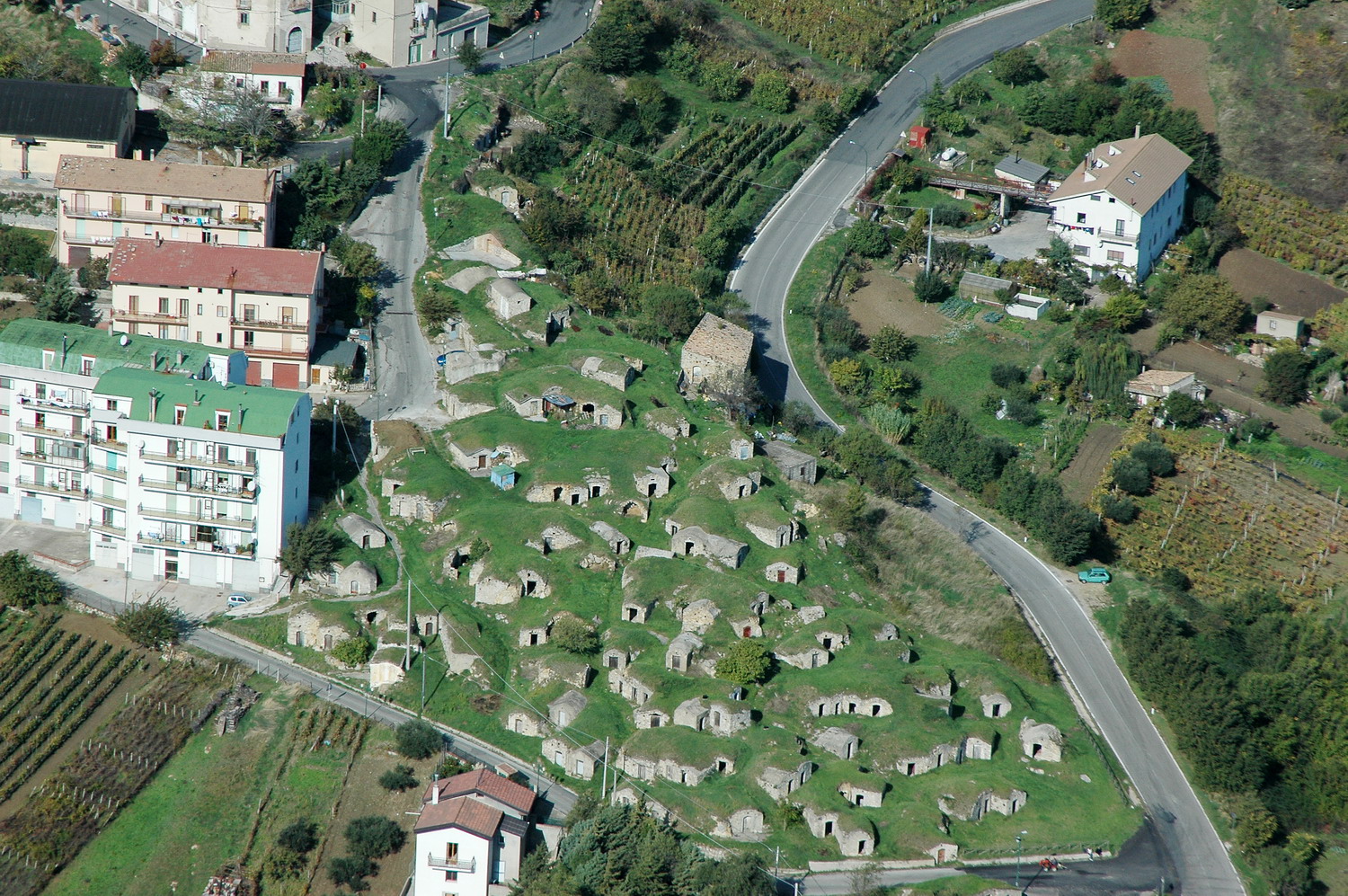
Urban Park of the Palmenti of Pietragalla in the Potenza, in Basilicata, whose center is built on a short terraced shelf, at 839 m a.s.l., on the left side of the Cancellara stream.
The name of the town seems to have originated around the 10th century from the medieval term. The coat of arms of Pietragalla is a rooster on three mountains and three towers included in the mountains. The three mountains represent "Terra", "Serra" and "San Michele". The three towers indicate the three main entrances to the historic center: "Arco Melazzi", "Arco Settanni" and "Arco Via Fratelli Bandiera".

The long raid that began in the first days of November 1861 by the large formations led by Carmine Crocco and José Borjes also affected the town of Pietragalla on 16 November, which was partly sacked.

Population and national guards resisted bitterly, causing numerous casualties to the attackers. Rescue arrived, the brigands were forced to retreat.

The Provincial Council of Basilicata of 11 January 1862, in considering Pietragalla's resistance as heroic, declared: «The citizens of Pietragalla [...] are also deserving of their homeland. walls of their fathers ”.

Collected the booty, the brigand formations, pursued by troop departments and contingents of national guards, retreated to Castel Lagopesole, where they tried to rearrange themselves.
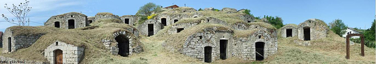
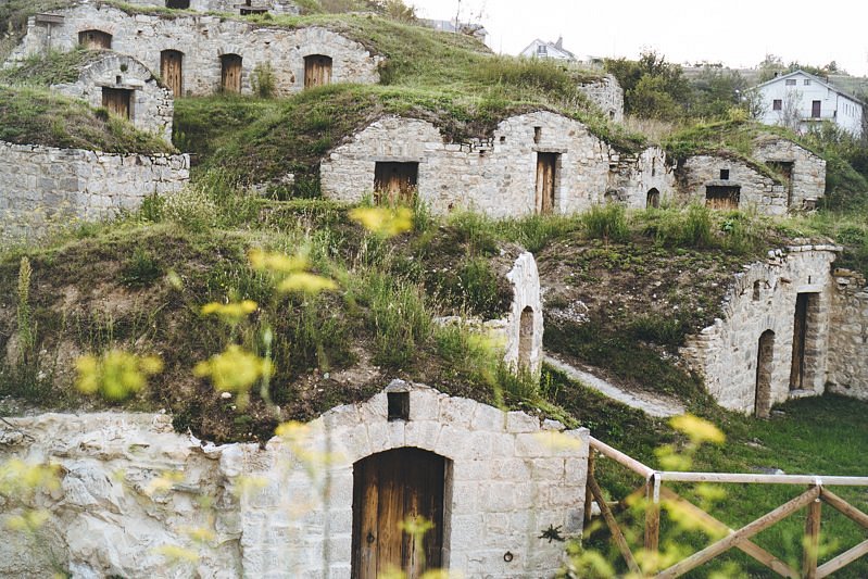
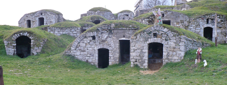
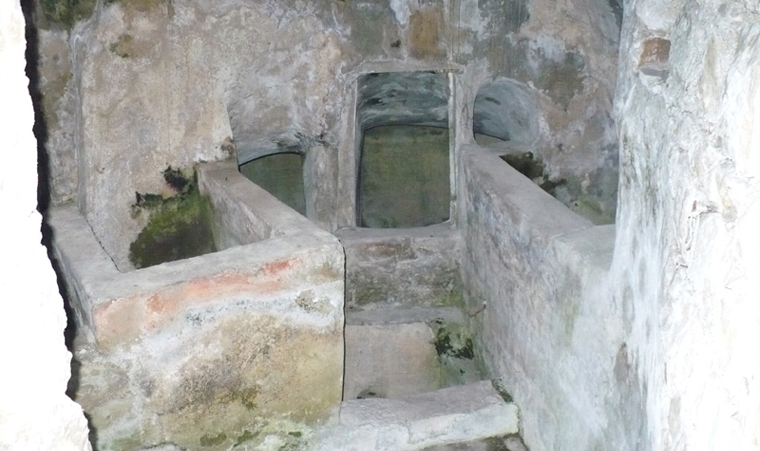
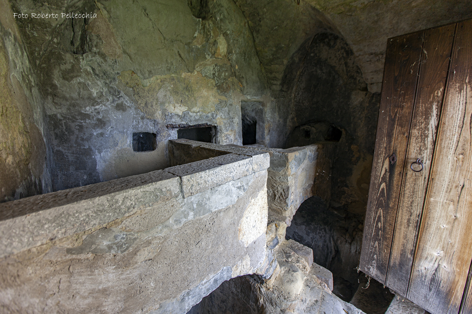
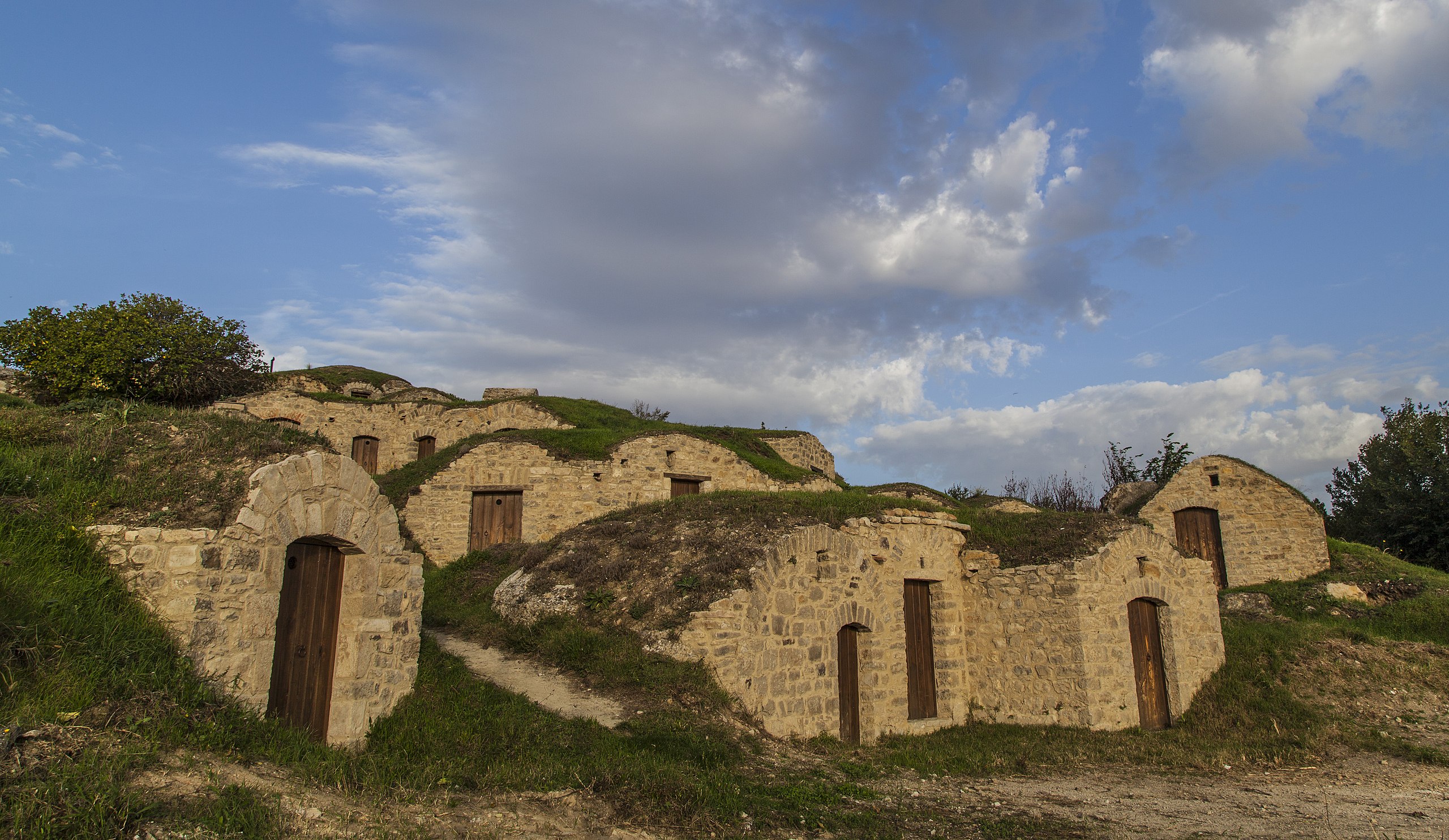
Pietragalla is the town of the fantastic “Palmenti”, in the local dialect defined as “rutte”, cellars-caves dug into the rock still used today for the conservation of wine.

The palmenti are a complex of underground structures, which originate in the first half of the nineteenth century.

The etymology of the term "palmento" has several hypotheses: some scholars maintain that it derives from the Latin pavimentum, indicating the floor level where the grapes were pressed; others argue that it derives from pavire, that is, the act of pressing, beating.

The millstone is an artifact that represents a singular realization of rural architecture, unique of its kind. The originated landscape context derives from an aggregation of artifacts perfectly in harmony with the territorial context.
These characteristic caves can be reached along the streets and alleys of the medieval village, which climb up to the highest point of the town dominated by the imposing bell tower of the mother church dedicated to San Nicola di Bari and the castle, the current Palazzo Ducale.

Near the town, on Mount Torretta, a settlement prior to the 11th century BC can also be visited. and inhabited until the third century BC.
The name of the town derives from “Pietra Gialla”, referring to the color of the material used for the construction of the houses, the tuff.

For the first time Pietragalla is mentioned in a document of the year 1118 and according to some sources, being the name of the town of medieval origins, the foundation of the town would coincide with the 10th century.
The town is influenced by the French presence, a period to which the construction of the current Breccia road dates back, an influence which, among other things, is also found in the use of the current dialect, in traditions and customs.
Until 1381 the fief of Pietragalla belonged to the counts of Morconi, then to Lorenzo Anzaloris.

In the fifteenth century the fief of Pietragalla then passed to the Counts of Pacentro and with the Orsini family began the expansion program of the Palazzo Ducale.
Video: Pietragalla - Urban Park of the Palmenti - Virtual Tour 360°
Map: Pietragalla - Urban Park of the Palmenti - Virtual Tour 360°
Address: Via Cadorna 6, 85016
Pietragalla (PZ) Basilicata
Latitude: 40.74863060187701
Longitude: 15.886069536209106
Site: http://www.comune.pietragalla....
vCard created by: CHO.earth
Currently owned by: CHO.earth
Type: Square
Function: Historic village
Creation date: 30-03-2021 05:59
Last update: 25/01/2022