Civitas Village

Civita was founded 2500 years ago by the Etruscans. It stands on one of the oldest roads in Italy, joining the Tiber (then the great navigation route in Central Italy) and Lake Bolsena.

The ancient town of Civita was accessed through five doors, while today the door known as Santa Maria or della Cava, represents the main one, moreover it is possible to access Civita from the valley of the badlands through a tunnel carved into the rock.

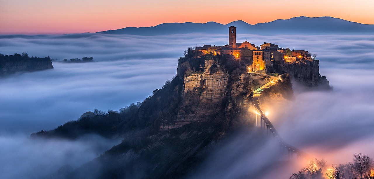
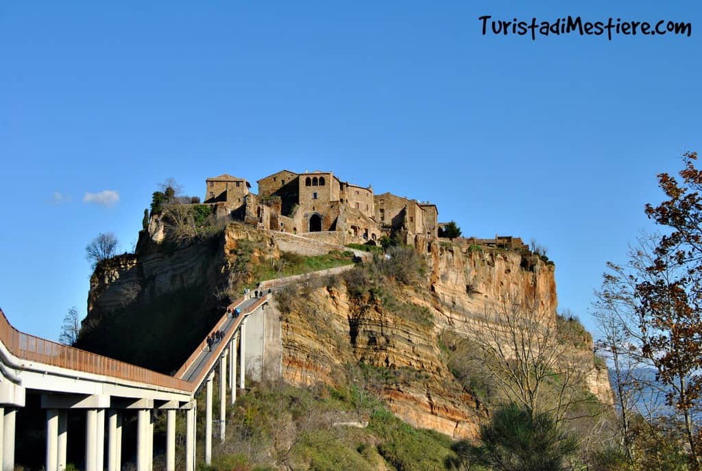
This village is located in the valley of the badlands, an area located between Lake Bolsena to the west and the Tiber valley to the east, in the municipality of Bagnoregio.
It consists of two main valleys: the Fossato del Rio Torbido and the Fossato del Rio Chiaro.
Originally these places were supposed to be gentler and more accessible and were crossed by an ancient road that connected the Tiber valley to Lake Bolsena.
The morphology of this area was caused by erosion and landslides.
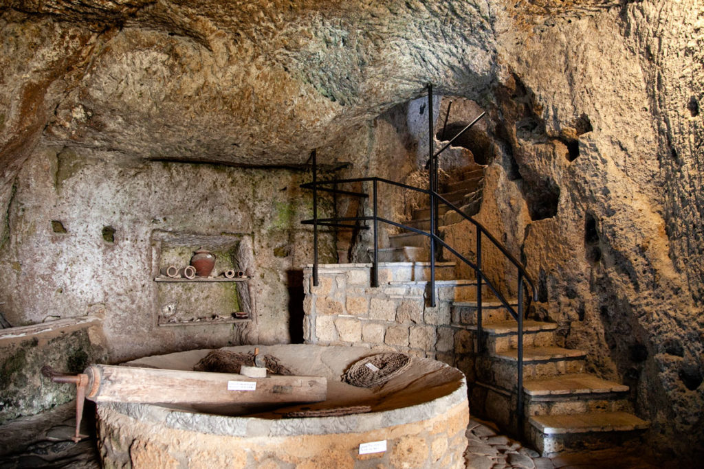
Inside the village there are various medieval houses, the church of San Donato, which overlooks the main square and inside which the S.S. Wooden crucifix, Palazzo Alemanni, seat of the Geological and Landslides Museum, the Bishop's Palace, a 16th century mill, the remains of the birthplace of San Bonaventura and the door of Santa Maria, with two lions holding a human head between their paws , in memory of a popular revolt of the inhabitants of Civita against the Orvieto family of the Monaldeschi.

Inhabited by only sixteen people (as of 2011) and located in an isolated position, Civita can only be reached via a reinforced concrete pedestrian bridge built in 1965.

The bridge can only be crossed on foot but the municipality of Bagnoregio, meeting the needs of those who live or work in this place, has issued a circular in which it declares that, at certain times, residents and authorized persons can cross the bridge on board of cycles and motorcycles.
The cause of its isolation is the progressive erosion of the hill and the surrounding valley, which gave life to the typical shapes of the gullies and which continues into the twenty-first century, risking to make the village disappear, which is why it is also called "the dying city" or, more rarely, "the dying country".
Video: Civitas Village
Map: Civitas Village
Address: Via Madonna della Maestà , 53C, 01022
Bagnoregio (VT) Lazio
Latitude: 42.62774649620379
Longitude: 12.113800048828125
Site: https://www.comune.bagnoregio....
vCard created by: BBCC
Currently owned by: BBCC
Type: City
Function: Public place
Creation date:
Last update: 11/02/2021