Dolo

The territory of the municipality is located in the center of the Riviera del Brenta, extending on both banks of the Naviglio. At the center of Dolo, the Naviglio doubles to form the so-called Bassa island.

The area is crossed by numerous other waterways, small canals and drainage channels such as the Seriola, the Serraglio, the Brentoncino and the Tergolino.
Dolo was probably a Roman mansion and a medieval village. Its development begins, however, only in the Late Middle Ages.

In 1457, after the damage to the crops in 1446-47 and the destruction of the Bassano bridge, the excavation of a canal, the '' sborador '', was authorized in the territory of Sambruson, through which the waters of the Brenta flow into the lagoon. Construction began only in 1459, this began in Mira Taglio and brought the Brentane waters to Giare. It had to have a width of about 35 meters, its riverbed must have been one and a half meters higher than that of the Brenta. It was to pass within a stone's throw of the Sambruson tower, in a straight line, and two bridges were to be built over the new canal. Of these two, only one was built near the incile, in this way the buildings to the right of the sborador remained isolated and therefore, according to attestations, at least from 1470 a third municipality was born in the parish territory of Sambruson, with the lands of Alture and Sambruson Tower: Sambruson Island.

In 1460 work began to rectify three loops of the Brenta, at Ca 'di Dolo' 'super Miram' '(beyond Mira), the vault of Dolo Dotto and near Mira. The aim was to make the Brenta flow faster, thus avoiding too much pressure on the banks. The works were hindered by the high costs so it was decided to employ people condemned by the state as labor, it is not yet known, however, if the works were actually started and completed.
In 1488 the Senate, given the inefficiency of the sborador, approved the construction of the Brenta Nova which, using the initial stretch of the sborador, would bring the waters of the Brenta to discharge into the Chioggia lagoon, the works proceeded slowly also because the construction of a reservoir with double doors essential for river navigation to and from Venice. All this was further slowed down by the Cambrai war in which Venice was involved and which brought a huge wave of violence in the Dolian territories in 1513.
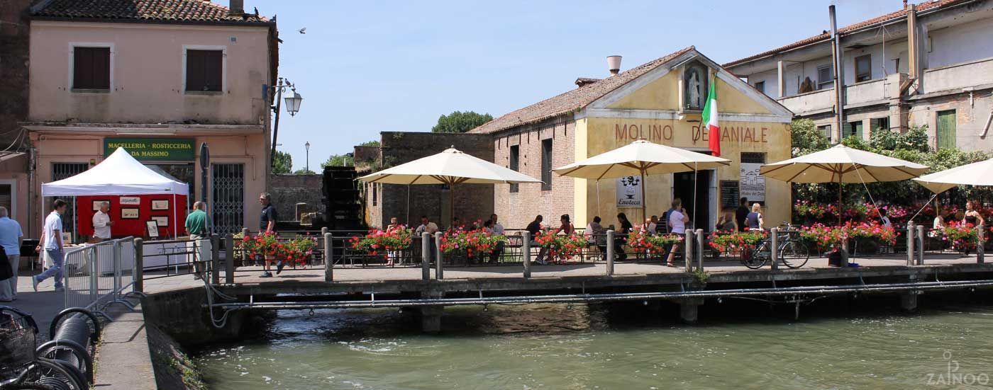
In 1534 the College of Waters arranged to continue the work on the Brenta Nova and the construction of mills and other buildings in Fusina. Thus came in 1540 when the College decided to divert the outlet to Brondolo and to move the construction of the mills from Fusina to Dolo. The mills were completed in 1551 and in three years they were equipped with 12 wheels or millstones. The buildings of the Brenta Nuova and the mills thus became the strengths for the economic development of the town. The Republic of Venice retained ownership of the mills which, however, it rented to private individuals.
Video: Dolo
Map: Dolo
Address: Via Benedetto Cairoli, 39, 30031
Dolo (VE) Veneto
Latitude: 45.42452490529665
Longitude: 12.074854373931885
Site: https://www.comune.dolo.ve.it/...
vCard created by: BBCC
Currently owned by: BBCC
Type: City
Function: Public place
Creation date: 13-01-2020 08:18
Last update: 18/08/2021